Making Thinking Visible Using Maps
Making Thinking Visible
The Mind is constantly fulfilling two functions - gathering information and processing it. As much as these two actions seem to be different, they are happening in a union. Gathering information uses various perceptive skill, and rely on the use of senses. With time using senses to learn has been deemed of lower importance than cognition (processing), as we see gathering and processing as separate functions, with processing being of higher value.
In this context, I look at maps created for children. Maps are mandatory tools for navigation, they develop a sense of position, and identity with the surroundings. The maps I see around me that are created for children are created with one focus - processing large amounts of geographical information. Most of these maps don't engage in the nuances of gathering information while using the perception of sensory tools. Perception is very often an undervalued learning tool that is not visible!
Here are a few examples of maps that are currently available for children. There are almost no maps of Indian cities made for children that I could set my hands on. The few I found rely hugely on iconographic images. The real sense of navigation is often neglected.
Below a map of Australia from the book Maps by Aleksandra Mizielinska and Daniel Mizielinska - 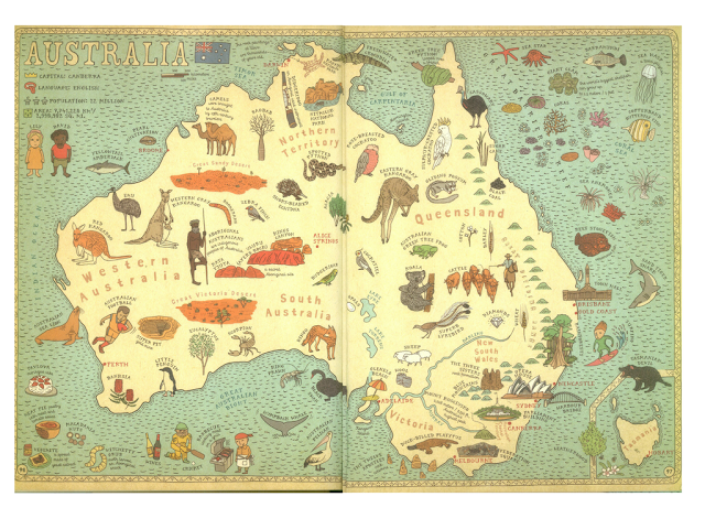


A map of Mumbai, purely Iconographic. Might help in a cultural overview, but limited in navigational possibilities.

A map of Cooke Town, Bangalore created by The Craft Caravan to introduce children to their neighborhood.

A map of South Parade, Bangalore created by The Craft Caravan highlighting places of historic relevance.
What then qualifies as a good map for children? What essential features should it contain that can balance aesthetic, and usability while keeping navigation as its core focus areas?
As a part of my practice, I will be studying maps for children and if they can become tools for visual thinking. To engage in this practice I will be using varied thinking and learning tools, interviews, affinity mapping, see-think-wonder, and water logic.
The findings of this study will be developed into a project proposal advocating methods to create better maps for children.

Comments
Post a Comment